THE BCH ARCHIVE
LOCAL HISTORY FOR
BIRTSMORTON
CASTLEMORTON
HOLLYBUSH
And The Surrounding District
King Charles 1
Early Enclosures of the Common Land
Researched and written by George Demidowicz, 2018
Banks and Ditches on the
Northern Malvern Hills
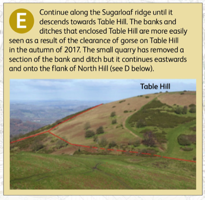
Anyone who has walked onto the Malvern Hills cannot fail to have noticed the massive bank and ditch which follows the main ridge. It is variously called the Shire Ditch or Red Earl’s Dyke and its origin and function are still shrouded in mystery.
This impressive earthwork so captures the imagination that less prominent boundary banks that rise and fall over the slopes of the hills have gone largely unremarked. They represent an additional layer in the historic landscape of the Malverns, and in contrast to the Shire Ditch, their date and purpose is known.
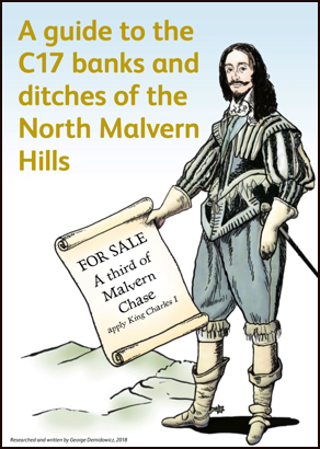
During his reign King Charles I was in severe financial difficulties and in constant dispute with Parliament, whose agreement was needed to levy taxes. With no recourse to Parliament Charles I attempted to raise revenue by exploiting the Royal Forests and his rights enjoyed on private Forests or Chases such as Malvern. This was shared between the neighbouring lords of the manor from Great Malvern, Mathon, and Cradley in the north to Bromesberrow and Berrow in the south. The Crown had, however, maintained its right to take the ‘venison and vert’, that is the deer and greenery, including the timber.
The plan to raise income for the royal coffers was for the King to relinquish his right to the ‘venison and vert’ over the whole Chase in exchange for enclosing a third of the area. This, the ‘King’s Third’ could then be leased or sold. The other ‘two thirds’ remained in the ownership of the neighbouring manorial lords and was left open for the commoners to graze their stock as from time immemorial. In 1628 the Chase was surveyed so that a third of each manor, not necessarily in a single enclosure, could be allotted to the king.
The proposal to enclose a part of Malvern Chace inevitably met with resistance, but it appears that much of the work of enclosure of ‘disafforestation’ was completed in the 1630s.
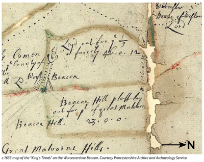
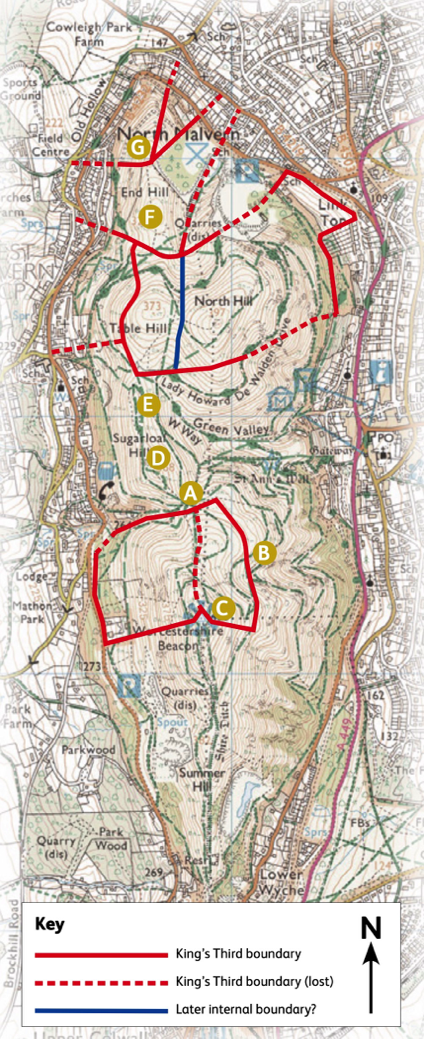
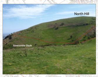
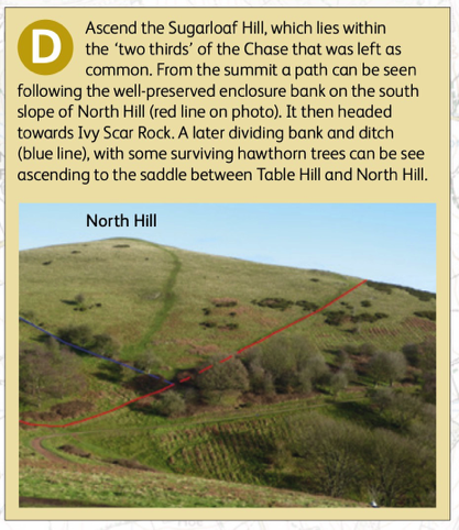
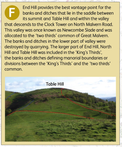
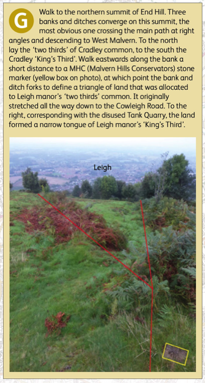
Although a map of the northern half of the Malvern Chase has survived (c.1633) showing the ‘King’s Thirds,’ it was not appreciated until recently that the ‘Thirds’ that were created at this time still survived in many places on the Malvern Hills enclosed by banks and ditches. The ‘King’s Thirds’ were not confined to the hills, but were also created on the flatter parts of the Chase east of the main ridge, most notably on Castlemorton
Common (Fairoaks Farm and Broomhill). The clearest banks and ditches lie on the hills north of the Wyche cutting. Here the ‘King’s Thirds’ were carved out of the manors of
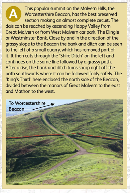
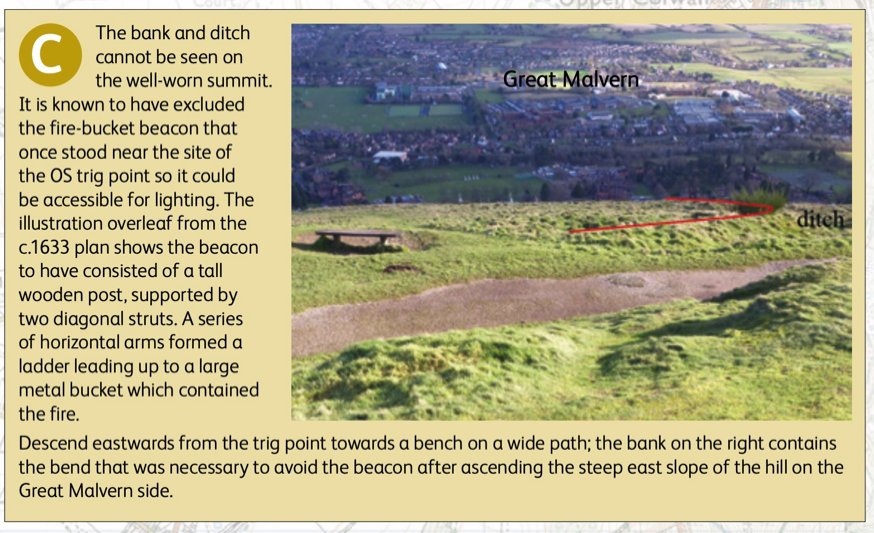
Great Malvern, Leigh, Cradley, Mathon and Colwall. By coincidence the best preserved and complete enclosure occupies the northern half of the Worcestershire Beacon, the most popular destination for visitors to the Malvern Hills. The ditch was normally dug on the outside of the enclosure, the bank on the inside, so marking clearly what was within the ‘King’s Third’ and what lay in the commoners’ ‘two thirds’.
The ‘King’s Thirds’ on the northern hills was purchased by Sir Cornelius Vermuyden, and passed through several owners such as the Strodes, the Lyttons, William Robinson (Lytton) and Richard Warburton, who sold to Thomas Hornyold in 1768. The Hornyolds were owners until 1919, but had already by 1879 agreed to dedicate their land for public use in anticipation of 1884 Malvern Hills Act.
By the 19th century the Hornyolds had leased their ‘Thirds’ on the northern hills invarious parcels. For the first time fences and hawthorn hedges were introduced onto the hills in order to prevent their tenants’ sheep and cattle straying onto the commoners ‘two thirds’. Iron posts and rails and the odd hawthorn tree can still be seen today, their modern equivalent today being the electric fences that contain the stock within shifting areas of stinting.
Without this control the animals would be a nuisance to local residents and a danger on the roads and we would soon lose the open aspect of the hills to naturalwoodland regeneration.