THE BCH ARCHIVE
LOCAL HISTORY FOR
BIRTSMORTON
CASTLEMORTON
HOLLYBUSH
And The Surrounding District
CASTLEMORTON MOTTE
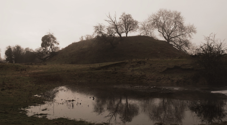
Castlemorton Motte
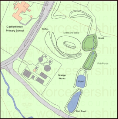
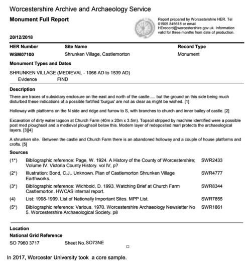
The Historic England Scheduling for this monument was the subject of a minor enhancement on 20 May 2015. This monument includes a motte castle, a moated enclosure and fishponds known as Castle Tump situated between the Malvern Hills to the west and the River Severn on the east. The monument survives as a motte mound with rampart and associated quarry ditch, a moated enclosure and four fishponds. The motte mound covers an oval area of 56m by 36m and is up to 6m high with a 19m by 12m flat platform on the top. Surrounding the motte is an earthwork rampart and exterior ditch. The motte is situated in the south east corner of a sub rectangular moated enclosure measuring 100m by 90m. This enclosure is later in date as it clearly cuts the eastern edge of the motte. A spring runs down the enclosure from the east to four medieval fish ponds. The four fish ponds are rectangular and orientated north to south.
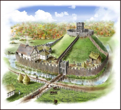
This motte and bailey castle was probably thrown up in the 12th century, possibly during the reign of King Stephen (1092-1154), by a member of the Folliott family. Its position is marked today by a Castle Tump (the mound). (A motte and bailey castle is a fortification with a wooden or stone keep situated on a raised earthwork called a motte, accompanied by an enclosed courtyard, or bailey, surrounded by a protective ditch and palisade) Its defences were probably of timber. However it would have stood out in the landscape as the residence of the lord.
There is a record of the existence of the castle in the early 13th century, but this could relate to the motte rather than the actual building.The castle, with its lands, was bought by Richard de Berkyng, Abbot of Westminster (1222-46 and the castle site lost its importance. It was probably this Abbot Richard who appointed a chaplain to celebrate divine service in the chapel of his castle here.
There have been no archaeological excavations of the earthworks.
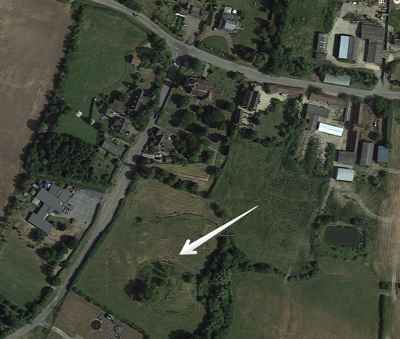
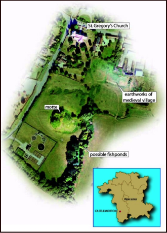
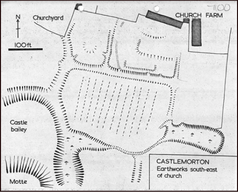
Adjacent mediaeval settlement
Medieval and/or Post Medieval settlement is visible as earthworks and cropmarks around the present village of Castlemorton. Fragmentary remains of ditched and embanked enclosures extend between the motte and Church Farms. These earthworks are much disturbed by quarrying and erosion but appear to represent the possible remains of Medieval and/or Post Medieval tofts (toft means the site of a house) separated by boundaries and hollow ways.
A possible hollow way extends behind the present properties at St Gregory's. Possible former property boundaries are visible at the east end of the hollow way.
An extensive, but discontinuous, system of ridge and furrow, and associated boundaries, extends between Newlands Grange and Miller's Court. Three possible lynchets (ridges formed along the downhill side of a plot by ploughing) are situated to the south of the stream.
In the area between Church Farms and Castlemorton motte and bailey there is a complex of former field banks. These now lie in improved pasture and survive as low earthworks. Ridge and furrow which once existed to the west and north-west of the village has now been flattened, although a substantial lynchet runs parallel with the backs of houses immediately north-west of the school.
A string of Medieval and/or Post Medieval fishponds are situated immediately east of the motte and bailey.
In 2017, Worcester University took a core sample.
In reading the text below, it is important to note that the word ’probably’ occurs in several places. There are very few hard facts. The existence of the fish ponds and the medieval village are both speculation. The only hard facts are the existence of the mound, ditch and earth rampart.